Discover the source of the river Mur! Sure, it’s not like finding the source of the Nile, but a very easy and pleasurable hike in the Austrian Alps. Experience from expeditions is not necessary. Just good shoes!
I have visited numerous places along the River Mur, which flows 348 kilometres through Austria, before continuing through Slovenia and Croatia. This is one of the main rivers in the state of Styria and it flows through its state capital and Austria’s second-largest city Graz. Hence, it was time to see where it all starts and find the source.
Where it all starts
The source of the River Mur (Murursprung) originates at an altitude of 1898 meters in Muhrtal, SalzburgerLand. Hiking to the source can be done on long, medium, or short hikes. Choose a route that suits your situation and fitness level. Moreover, several of the routes combine gravel roads and trails which don’t require mountaineering skills. Here are 3 different route suggestions that all lead you via the Sticklerhütte at 1767 meters, from where you embark on the last stage to the source.
The Long Route
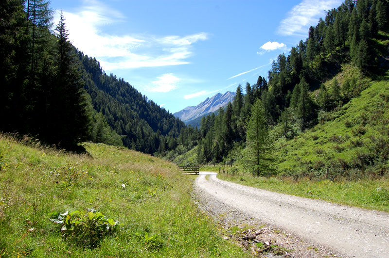
The first stage of the longer route starts from the free parking lot by the Hohe Tauern National Park station at Rotgüld. It saves you € 5 by not using the toll road and gives you more time in nature. You start hiking at 1360 metres above sea level and work your way up to 1567 metres along 3.9 kilometres, to the end of the public road and the last parking lot. This should take you about 1 – 1 ½ hours. As the road winds its way deeper into the valley the landscape gets wilder. Moreover, the scenery is nothing less than stunning, as you are surrounded by mountains that peak at over 2000 metres above sea level.
< Click on the images to enlarge >


The Medium-Long Route
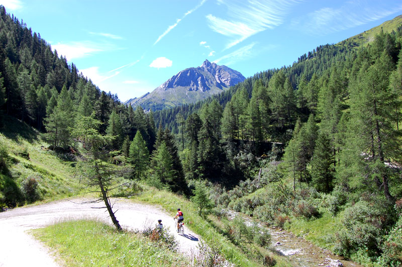
The start of medium-long route begins at the end of the road that is open to the public. From the car park at Muritzen (1567 metres) you hike for another hour or so. Simply follow the gravel road that keeps climbing 3.4 km through the valley, until the Sticklerhütte at 1767 metres. On the way, about 600 metres from the car park, you reach a crossroad by the Hubertuskapelle. From the small chapel, you have a great view of a side valley. Nonetheless, stick to the road continuing to the right.
The Short Route (last stage)
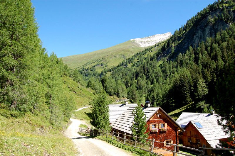
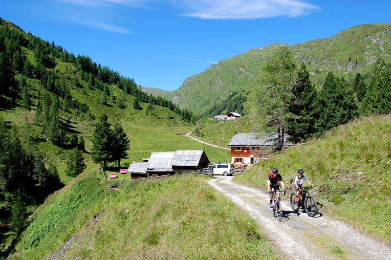
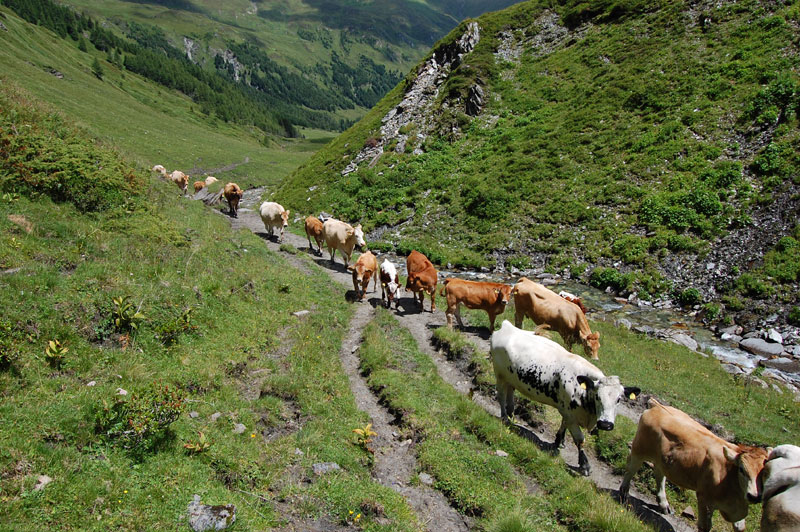
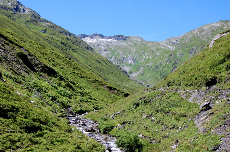
You’ve got about an hour or hour and a half to the source of the river Mur. You don’t have to worry about getting lost as the trail takes you along the Mur all the way. Beyond the mountain lodge, you continue hiking on trails. More often than not well-trodden by cattle rather than by humans. If you have been hiking up from any of the car parks, the Sticklerhütte is the perfect watering hole before you venture into nature again. At the Sticklerhütte you have arrived more or less above the treeline, and the landscape opens up for great views of the surrounding mountains.
The river Mur
The source, marked with the usual Austrian yellow hiking sign, is right below a rock, where water trickles out. The river Mur originates at 1898 metres and flows about 295 kilometres through Austria before continuing through Slovenia, Croatia and Hungary where it after 453 kilometres empties into the river Drava and its waters finally ending in the mighty Danube.
Coordinates: 47° 7′ 48″ N, 13° 20′ 50″ O
-
Whether you’re chasing snow-covered slopes or blooming alpine meadows, Austria has something to offer every season. This guide will help you decide the best time to visit Austria based on your interests. Winter (December to March): A Snowy Paradise During winter, Austria transforms into a haven for snow enthusiasts. The Austrian Alps, particularly regions like […]
-
We boarded the boat MS “Klagenfurt” at Metnitzstrand Park in Klagenfurt at 10:00, where a reserved table awaited us in the lounge. It was worth postponing breakfast and having it served on the water instead. The aroma of freshly baked rolls filled the lounge, which, along with cold cuts, juice and coffee, was served as […]
-
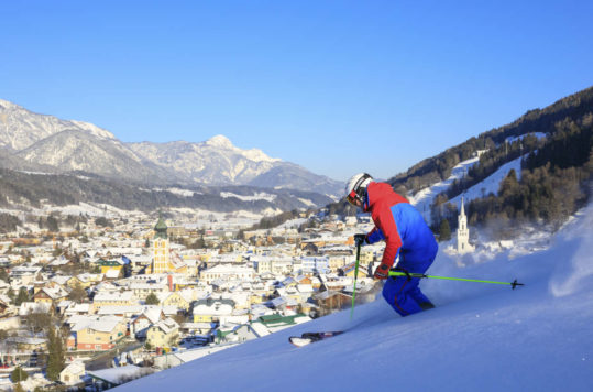
The historic small town in the Styria region of Austria, with about 4500 inhabitants, is surrounded by the majestic Dachstein mountains. The winter season usually starts at the beginning of December and runs until the beginning of April. Skiing day and night Schladming offers 123 km of slopes spread over four interconnected ski areas: Planai, […]
-
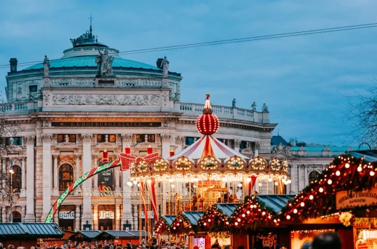
With the scent of roasted chestnuts and mulled wine filling the air, Vienna’s Christmas markets offer a delightful blend of traditional crafts, festive treats, and holiday cheer. Whether you are searching for handcrafted gifts or want to soak in the festive atmosphere, the Christmas markets in Vienna are a must-visit during the holiday season. Viennese […]
-

With a culinary heritage reflecting diverse cultural influences and historical roots, Austria offers a hearty and flavorful gastronomic adventure. Signature dishes like Wiener Schnitzel, Knödel and Tafelspitz showcase the country’s love for robust flavours and quality ingredients. Street foods like Käsekrainer add a savoury touch to Austrian culinary traditions. Buschenschanks in Austria: A Blend of […]
-
Vienna, the capital of Austria, is a city where history and innovation intertwine seamlessly. As you wander its streets, you’ll encounter a fascinating array of architectural styles, each telling a unique story. From Gothic cathedrals to avant-garde masterpieces, Vienna invites you to explore its rich heritage. Let’s embark on a visual tour of the city’s […]